Trail logs and stories
Journal
Every trail log has the track, the numbers, and our review of the trail. The blog posts are the stories around them. Newest first, and every trail is on the Trail Map.
-

How Trails Offroad Helps Us Explore Public Lands the Right Way
Matching trails to the rig, knowing whose land you’re on, and checking conditions from people who were just there.
By Dan Ranta · 4 min read
-
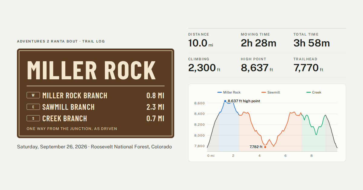
Miller Rock
A dead-end network off Hwy 7 west of Lyons: a steep entrance climb, then out and back on all three branches, Miller Rock, Sawmill, and Creek.
10.0 mi · 2,300 ft of climbing · high point 8,637 ft
-
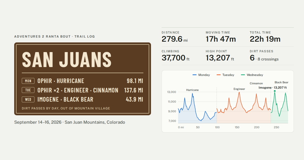
San Juans
Three days out of Mountain Village: Ophir three times, Hurricane in the fog, Poughkeepsie Gulch the backwards way, Engineer, Cinnamon, Imogene, and Black Bear.
279.6 mi · 37,700 ft of climbing · high point 13,207 ft
-
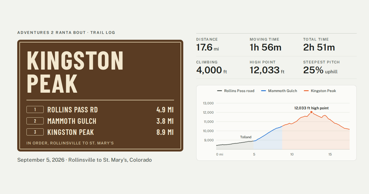
Kingston Peak
Rollinsville to St. Mary’s by way of Tolland, Mammoth Gulch, and the Kingston Peak ridge, a week before the San Juans.
17.6 mi · 4,000 ft of climbing · high point 12,033 ft
-
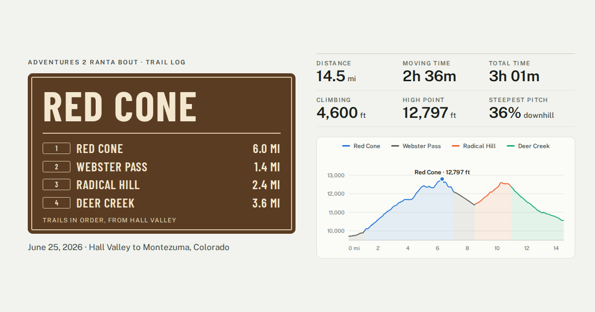
Red Cone
Red Cone, Webster Pass, Radical Hill, and Deer Creek across the Continental Divide, our first run in rain and fog.
14.5 mi · 4,600 ft of climbing · high point 12,797 ft
-
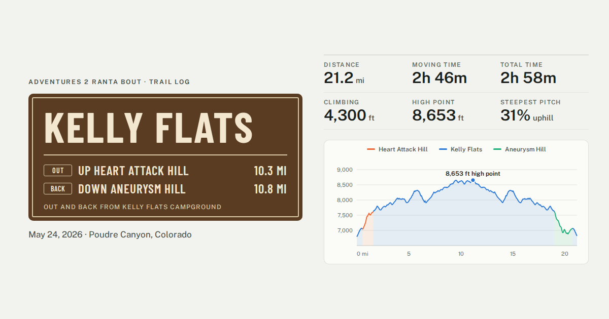
Kelly Flats
Up Heart Attack Hill, out the ridge above Poudre Canyon, and back down Aneurysm Hill.
21.2 mi · 4,300 ft of climbing · high point 8,653 ft